Virtually every year-round resident of island communities and most coastal communities will be affected by sea level rise, either directly because their home or business will experience flooding, or indirectly as property taxes are shifted inland to year-round residents.
In this analysis, we worked for the Island Institute and local communities to determine the level of impact on tax parcels and buildings. We reviewed three different scenarios of sea level rise ranging from 1.6 feet to 6 feet.


We developed analysis of how sea level rise would impact three distinct land use types: residential, commercial, and public. The land use types were chosen after discussion with communities and determined that while there will be some residential flooding, it may be the impact on commercial and publicly owned lands that will cause the greatest hardship.
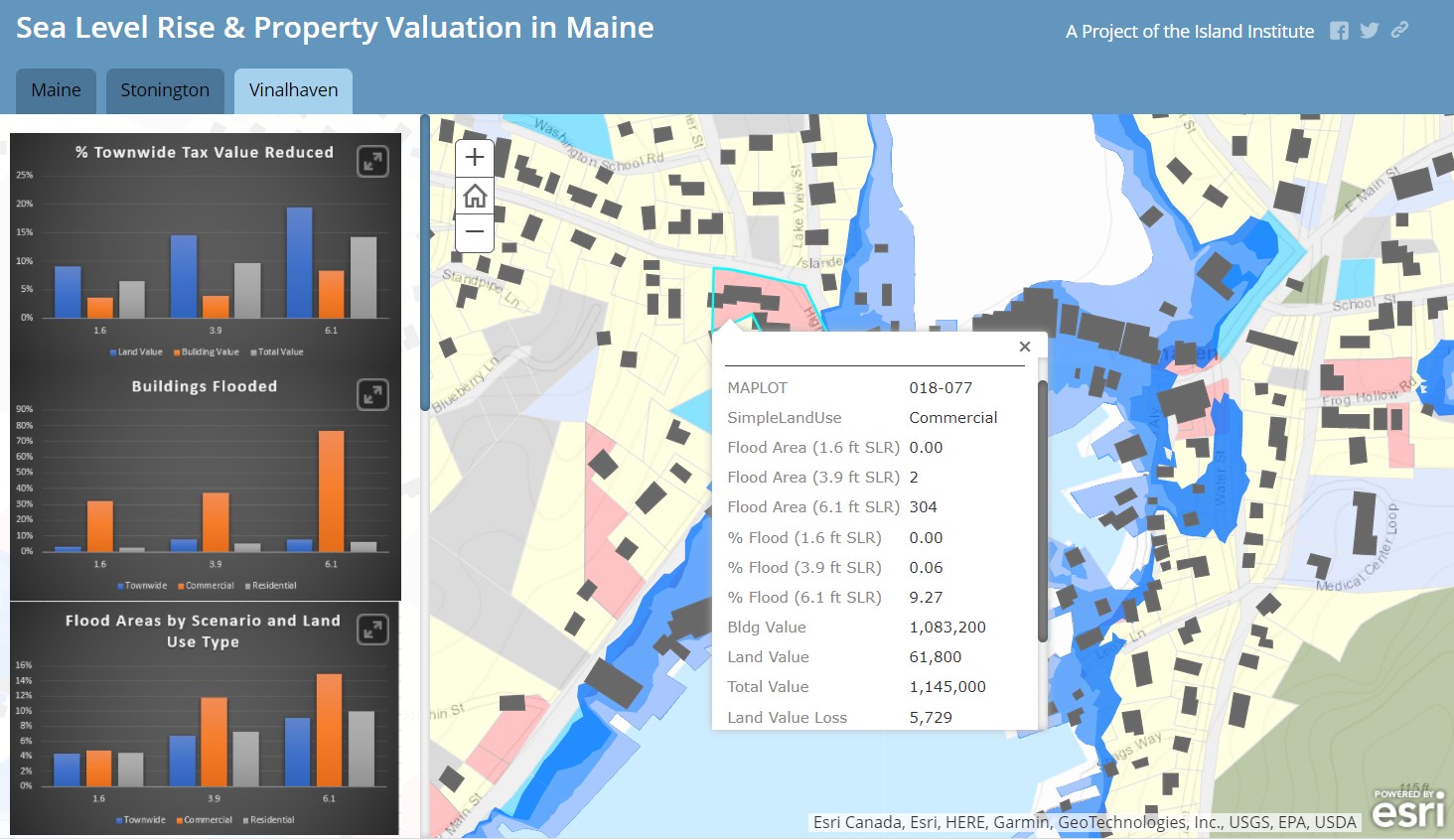
This map shows the overall impact of flooding on the various land use types, as well as the impact on individual parcels. In order to view a Storymap showing the results of this analysis developed in collaboration with the Island Institute for Vinalhaven, click the link below